
3D File Building
3D File Creation Services
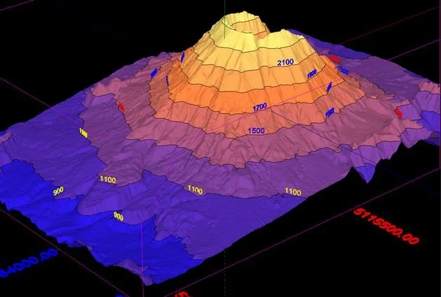
3D file building services involve the creation of detailed three-dimensional models from survey data. These services begin with the collection of geospatial information through various methods such as aerial surveys, laser scanning, or traditional land measurement techniques. Once the data is gathered, it is processed using specialized software to generate accurate, high-resolution 3D models.
These models are invaluable for visualizing terrain and structures, providing enhanced insights for planning and development projects. They can be used to assess land uses, analyze topography, and facilitate better decision-making. Additionally, 3D models can be utilized in presentations to stakeholders, ensuring clearer communication of project visions. Overall, 3D file building enhances the accuracy and efficiency of land surveying, leading to improved project outcomes.

Work with GradeWorks!
Choosing GradeWorks LLC as your land surveying partner means investing in quality, reliability, and expertise. Let us assist you in achieving your project goals efficiently and effectively.